Project Details
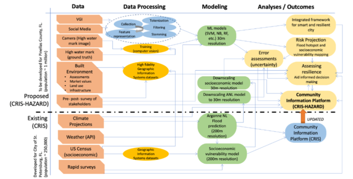
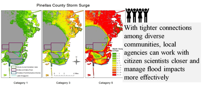
With increasing extreme weather events and a changing climate, there is an urgent need to assess, manage, and monitor flooding-related risks and communicate such risks to impacted communities in an efficient and timely manner.
Yet, achieving these objectives has been complicated by several socio-technical challenges, including:
- The unavailability near real-time, two-way communication of flood-related hazards for the impacted communities.
- The lack of high-fidelity models of flooding risk and risk trajectories at a fine spatial and temporal scale.
- Limited knowledge about the level of uncertainty embedded in the data and models and how that informs decision-making.
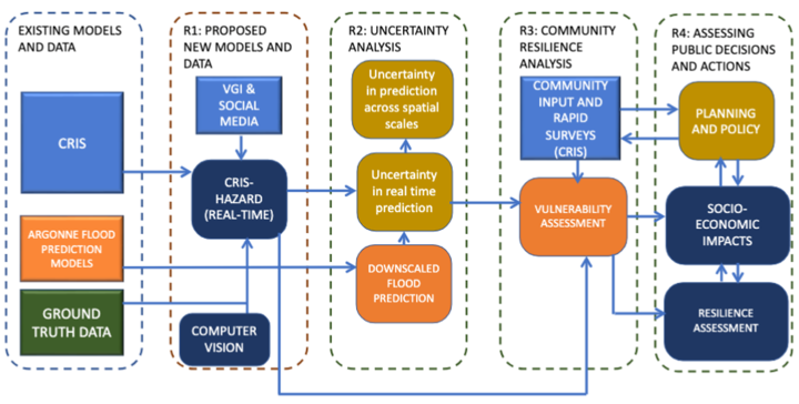
Intellectual Merit
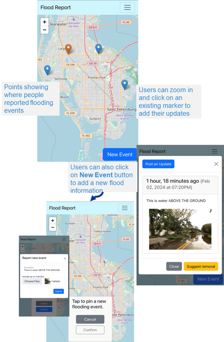
Crowdsourcing App Available Here!
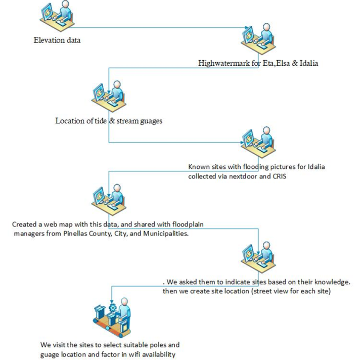
High Watermark Camera Site Selection
We will have 30 cameras placed around Pinellas County in flood-prone areas for monitoring the area in near real-time. The camera locations were selected using steps identified below.
Broader Impact
- Groom citizen scientists to partner in our model calibration, information processing, and dissemination efforts.
- Connect communities to decision-makers and provide easily accessible information on risks and vulnerability to individuals and communities.
- Understand the differential impacts of flooding on diverse communities in the digital divide and marginalization context.
Future Goals